Aerial-to-plan comparison
Bring new aerial imagery into a repeatable comparison against the approved surface plan.
Quarterly surface plans for South African mines
TerraDraft proposes polygon changes against the latest approved surface plan, gives the responsible surveyor full review control, and prepares an auditable output for DMR submission.
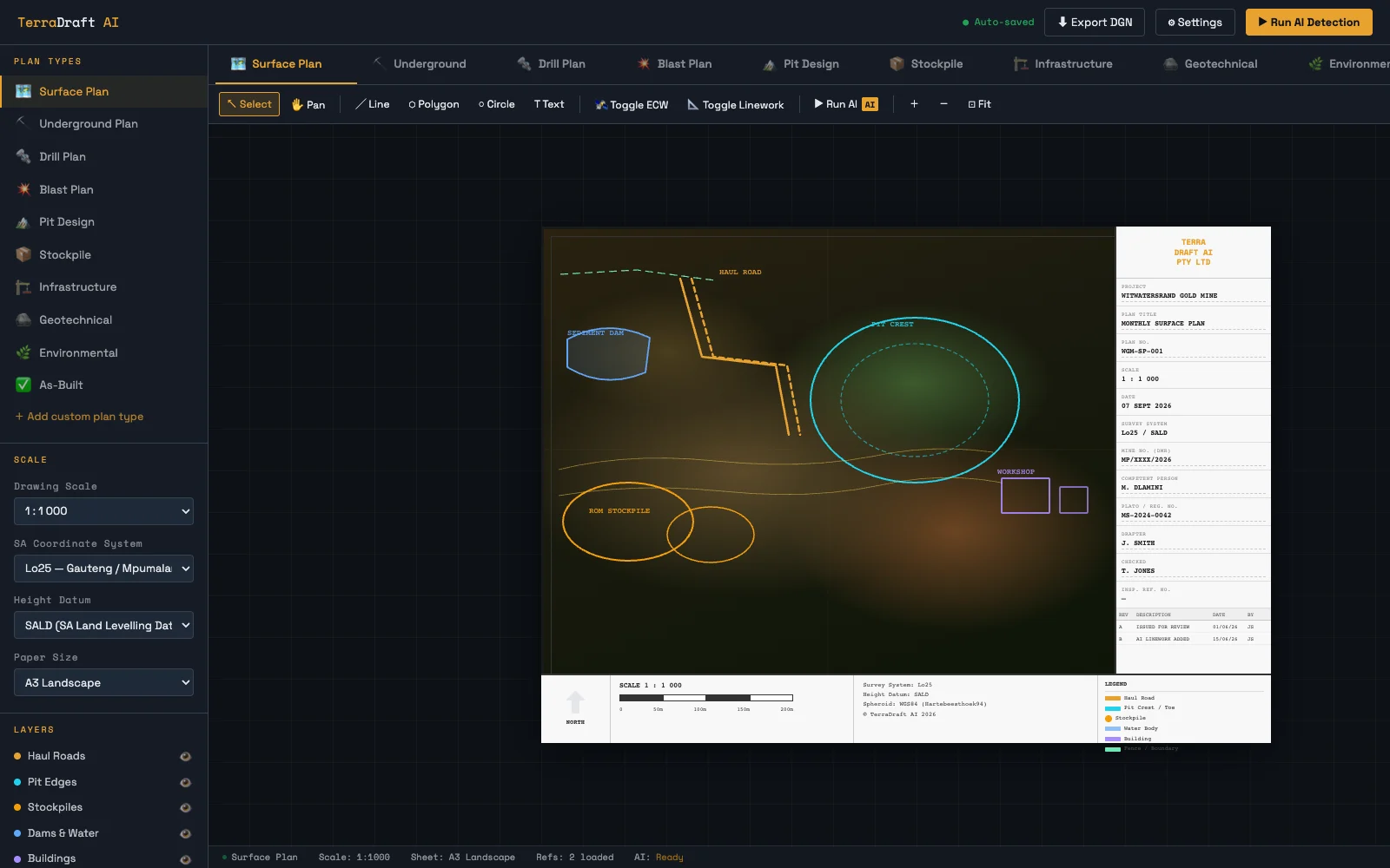
The first product
Quarterly surface-plan updates require skilled, repetitive comparison between current aerial information and the mine's approved plan. TerraDraft is being shaped around that one practical job first.
The MVP does not attempt to replace CAD platforms or professional surveying. It concentrates on change detection, polygon drafting, review history and a controlled handover to the responsible surveyor.
See the site differently
A current aerial view gives the review process a clear starting point. TerraDraft is being designed to turn visible change into structured polygon proposals that a surveyor can inspect and approve.
Aerial context first. Professional judgement throughout.
The quarterly workflow
Add the latest aerial view and the current approved surface plan.
Align the source material and identify areas that appear to have changed.
Create traceable polygon updates without overwriting the approved source.
The surveyor reviews, corrects, accepts or rejects every proposed change.
Package the approved plan and audit record for DMR submission.
Bring new aerial imagery into a repeatable comparison against the approved surface plan.
Turn visible change areas into editable proposals with source and version traceability.
Keep approval, correction and rejection decisions visible before any plan is released.
Retain the evidence needed to understand what changed, who reviewed it and what was approved.
Professional control
TerraDraft is designed as a human-in-the-loop workflow. It can identify, organise and propose changes, but it cannot approve a plan or replace the professional responsibilities of the appointed surveyor.
Proposals remain separate from the approved source until reviewed.
Each release is tied to a responsible professional's decision.
Inputs, proposed edits, corrections and approval status remain traceable.
The MVP output is validated around the quarterly DMR workflow.
Almost ready for launch
TerraDraft and Etashi are preparing the focused surface-plan MVP with mine and survey partners. Register your interest for launch updates, or contact us directly to discuss an early pilot.
Product facts
South African mines and survey teams responsible for recurring surface-plan updates and professional review.
No. The product proposes drafting changes. The responsible surveyor reviews and approves the released plan.
The MVP prepares an approved plan output and audit record. Submission remains part of the mine's controlled professional process.
Not initially. Other plan types, deeper automation and field integrations follow only after the quarterly surface-plan workflow is proven.